Operating system: Android 4.2+ (Jelly Bean) Interface language: Russian, English
Nautical Almanac software is used to calculate the equatorial and horizontal coordinates of the Sun, Moon, navigational planets and stars. These parameters are required for solving problems of nautical astronomy. This program completely replaces the Marine Astronomical Yearbook (MAE, in Russia) published by the Institute of Applied Astronomy of the Russian Academy of Sciences and its analogue The Nautical Almanac, published by Her Majesty's Nautical Almanac Office.
Operating system: Android 5.1+ (Lollipop) Interface language: Russian, English
The program is used to identify stars by observed altitude (zenith distance) and azimuth.
The program includes 9096 stars, the list of which can be found here.
Operating system: Android 5.1+ (Lollipop) Interface language: Russian, English
The main task of nautical astronomy is to determine the position of a ship in the sea from the measured altitudes of the luminaries. The astronomical method of locating a location has many advantages: it is available everywhere, it is completely autonomous and accurate enough for the high seas. But this method requires special training, both for making observations and for calculations. The proposed software package is used to automate computational processes in the course of determining the position of the astronomical method.
The program for calculating the time of sunrise and sunset of the Sun and the Moon, the beginning and end of twilight, as well as the azimuths of the rising and setting of the Sun and the Moon.
A program for calculating the altitude and azimuth of a luminary according to tables TBA-52 or TBA-57. For training and checking the correctness of manual calculation.
The sphere is a mathematical model for solving problems of nautical astronomy, which allows one to consider the stars not in space, but on the surface of a sphere.
Program for converting geodetic coordinates between WGS-84, SK-42, PZ-90 parameters and national coordinate systems. Conversion of geodetic coordinates to topographic coordinates of the Gaussian projection and vice versa.
Gregorian and Julian calendars; Arabic lunar calendar; Chinese and Hebrew lunar-solar calendar.
Operating system: Android 5.1+ (Lollipop) Interface language: Russian, English
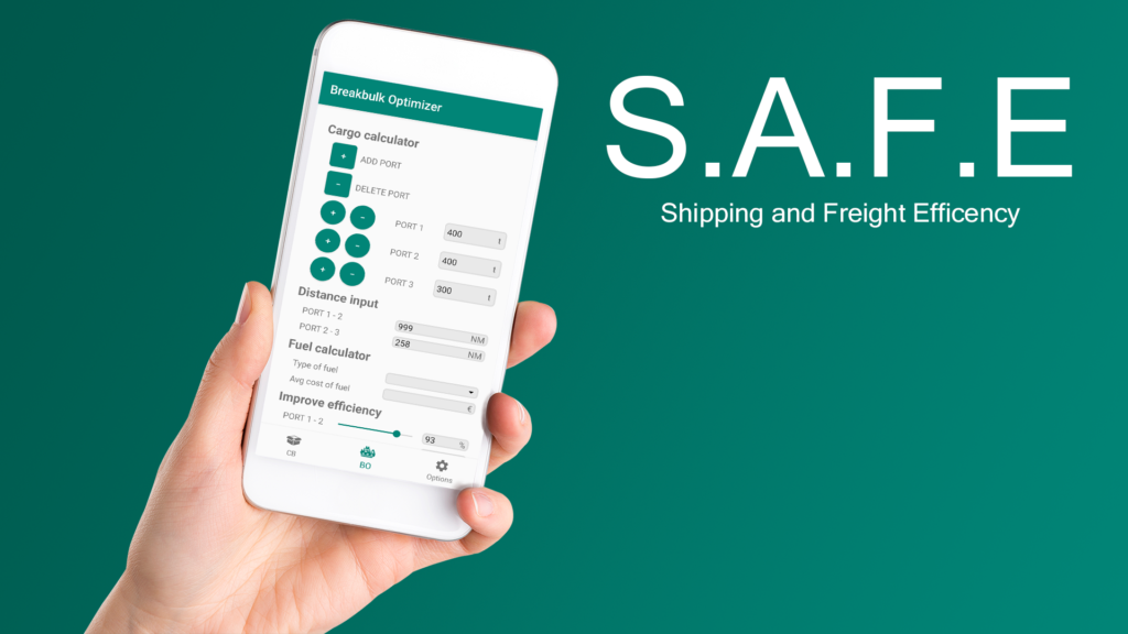
S.A.F.E — Shipping and Freight Efficiency mobile app was developed as a case solution for the Finnish transport company MacGregor. The application is necessary to optimize logistics processes, to control carbon dioxide emissions during sea transportation and some other tasks.
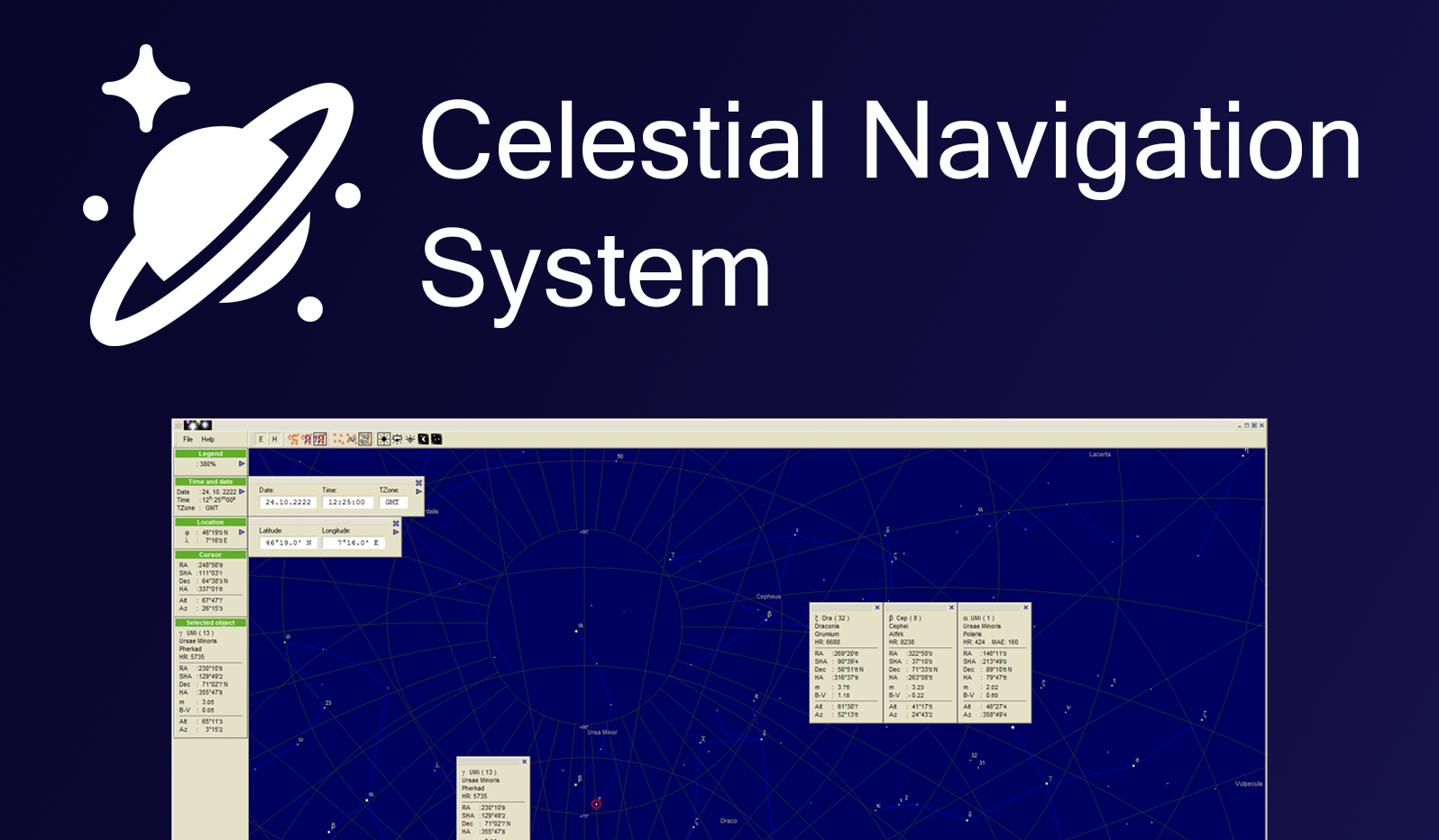
Operating system: Windows XP/7/8.1/10 Interface language: Russian, English
Recently, interest in astronomical navigation has been growing. Research and development work is underway in the field of modernization and development of classical instruments necessary for navigation along celestial bodies. The proposed software is a complete system for astronomical navigation.
The project was supported by the
Foundation for the Promotion of Small Businesses in Science and Technology (Фонд содействия инновациям, in Russian), support was provided within the framework of the federal project “University Technological Entrepreneurship Platform”.
Intellectual property
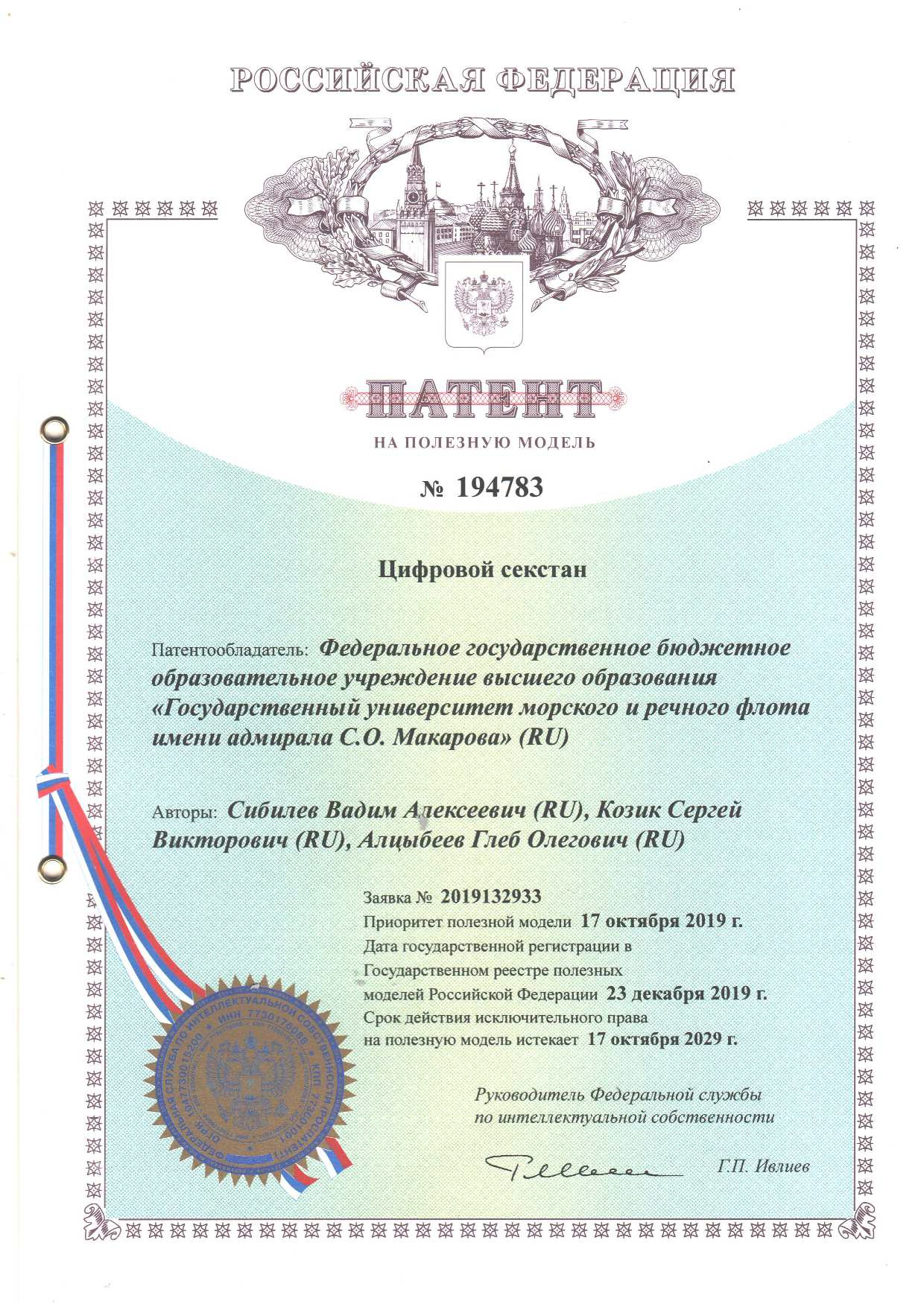
Utility model patent
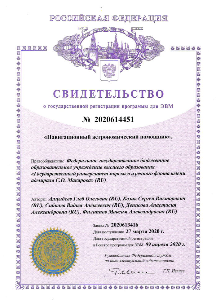
Certificate of state registration of computer program
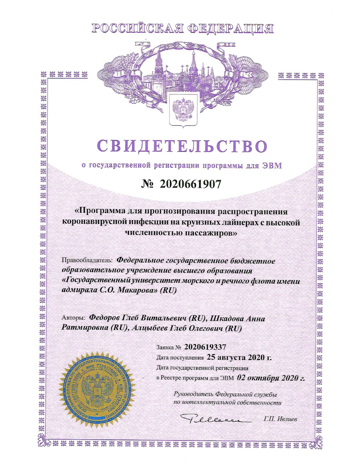
Certificate of state registration of computer program
Certificate of state registration of computer program
Contacts
Address: Krasnoputilovskaya Street, 69, office 505, Saint Petersburg, Russia Phone number: +7 (931) 531-43-75 E-mail: support@alcysoft.ru